Ontario's Plain-English Guide to Custom Home Building📞 705-533-1633 | ☎️ 1-866-868-6606 | ✉️ info@icfhome.ca
How to Read Ontario Survey?
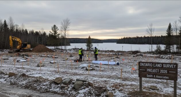
Surveys, explained
Read the parts that matter
Avoid “oops” builds
How to Read an Ontario Survey Like You Actually Own the Place
A survey can look like someone spilled spaghetti on graph paper. But it is really just a legal map: boundaries, evidence, and the “you can’t build here” zones hiding in plain sight. Read four things – the title block, the legend, the boundary evidence (pins and monuments), and the easements and rights-of-way – and you are ahead of 90% of people. This guide walks all four in plain English, plus the 5-minute checklist we run on every site visit, so you know what you can build before you fall in love with a lot that fights back. From 45 years of building across Simcoe County and Georgian Bay.
What a survey is (and what it is not)
An Ontario survey plan is prepared by an Ontario Land Surveyor, and it is built on research plus physical evidence – not vibes. It is not a grading plan, not a building permit, and not proof your fence is in the right place. Think of it as: “Here is what the land records and the evidence on the ground say your boundaries are, and here are the interests that affect them.”
| Plan type | What it is | What it does NOT tell you |
|---|---|---|
| Registered Plan of Subdivision | Creates lots; shows dimensions and monuments. | Doesn’t confirm current zoning or servicing approvals. |
| Reference Plan (R-Plan) | A deposited plan showing “Parts” for severances, easements, or road widenings. | May NOT mean the land is buildable – it just describes parts and interests. |
| Surveyor’s Real Property Report (SRPR) | Often shows buildings and highlights encroachments and interests. | It is a snapshot in time – it can be out of date if things changed. |
The big misread: people assume a Reference Plan means “buildable.” It does not. Buildability depends on zoning (setbacks, coverage, height), servicing (septic/well space), and any approvals – the survey just tells you the shape of the playing field. Sort the zoning side on the zoning decoder.
The 4-step method to read any Ontario survey
Title block first (this is where adults start)
Before you zoom into the squiggles, read the title block. You are looking for the plan type and number, the surveyor’s name and date, the legal description, the scale, and the north arrow. This tells you what document you are holding and whether it even matches the parcel you care about.
Find the legend (the translation key)
Surveys use abbreviations because surveyors have better things to do than write novels. In Ontario you will commonly see monument abbreviations like IB (iron bar), SIB (standard iron bar), SSIB (short standard iron bar), and CC (cut cross). The legend is where those symbols get explained – so you know what is supposed to be in the ground.
Read the boundary lines like a builder
Your boundary is usually the heavy outline, or the line called out as the limit of the parcel. Along it you will see bearings (direction) and distances (length), typically in metres. Plans often note grid bearings, ground distances, and scale factors because the plan uses a defined reference system. To answer “can I fit a garage here?” your quick win is finding where the corners are and how long each boundary is – that is the foundation of setbacks and the building envelope.
Hunt for easements and rights-of-way (the sneaky stuff)
Many plans show evidence that affects title – fences, retaining walls, and especially easements and rights-of-way. These appear as labelled strips, notes, or references to registered instruments. If you see an easement running down the side yard, that is not decoration. It can restrict what you are allowed to build or where you can put services.
“Found” vs “Set”: why those two words matter
Found means the surveyor located existing evidence. Set means a monument was planted or re-established based on records and evidence. Either way, do not assume the corner is exactly where the PDF line looks. On many properties, the physical monument is the star of the show and the measurements are the supporting cast.
Builder translation: do not “fix” a boundary with a tape measure. That is how neighbour disputes are born. The legal boundary is the surveyed evidence – not the fence, and not what you measured off a PDF on your phone.
Turning a survey into a build – two ways to do it right
Do it yourself with the step-by-step PDF, or hand us the survey and we will tell you what you can actually build on the lot.
Done for you – we read the lot
We turn your survey into a plan
What fits, where it goes, and what the lot will cost to build on.
Send us the survey and we read the boundaries, easements, and setbacks, overlay the zoning envelope, flag the servicing constraints, and tell you what you can realistically build – before you spend on drawings or fall for a lot that fights back. Then we can draw the permit-ready set to fit. Anywhere in Ontario.
- We read the easements and rights-of-way that move your footprint
- Zoning envelope overlaid: setbacks, coverage, height
- Servicing checked: room for septic, well, and the driveway
- 45 years building on tricky Georgian Bay and Simcoe lots
Free quote, no obligation.
A real person gets back to you within one business day
Do it yourself
The Ontario Building Permit Bible
Your permit, done yourself – without the guesswork.
$10,000$29.99one-time
Everything a builder does to take a lot from survey to permit – including how a survey, site plan, and zoning fit together – in one plain-English playbook.
- How to turn a survey into a dimensioned, reviewer-ready site plan
- The complete-application checklist, so the file doesn’t bounce
- Who to hire to draw it, in what order, and what to pay
- How to never fail an inspection – and the mistakes that cost the most
30-day money-back guarantee.
Get instant access – $29.99 →
Secure checkout – download in 2 minutes – yours forever
Survey raises a Code question?
Setbacks, foundation near a boundary, or what a slope means for your build – some of that is the Code, not the survey. Ask our OBC Code Navigator your exact question – the first two are free, and you can grab the OBC PDF there too.
The 5-minute survey checklist (steal this)
This is the quick pass we run on every site visit. If you can tick all six, you are in good shape. If you cannot, you do not need to panic – you need to ask questions before you build.
Boundaries & corners
- I can identify the boundary outline – not the fence
- Corner monuments are shown, or explained as set / not found
- Distances are in metres and make sense lot to lot
- Notes say whether distances are ground or grid (important!)
Interests & sanity
- Any easements or rights-of-way are clearly marked
- I’m not measuring the PDF on my phone screen
- The legal description matches the parcel I’m buying
- The plan type tells me what it can and can’t confirm
Looking at a lot and not sure what you can build? Send us the survey.
We will read the boundaries, easements, and setbacks, check the lot against zoning and servicing, and tell you straight what fits and what it will cost to build on – before you make an offer or pay for drawings. The cheapest survey mistake is the one you catch before closing. Quick paid consult: we scope it on a call and send a secure payment link, so you only pay once you know what you are getting.
Turning a survey into real costs
A survey is where “I want” meets “I’m allowed.” Easements can push a house footprint, long boundaries can mean longer (more expensive) services, and tight geometry can force design changes. If you are early in planning, ballpark tools keep the budget honest before you fall in love with a lot that fights back:
- Size the home and the build with the Custom Home Building Calculator.
- On a private-services lot, check septic space and cost with the Septic System Calculator (Ontario).
- Price the lot prep – clearing, driveway, grading – with the Land Development Cost Calculator.
And if you are thinking ICF walls, there is a bigger planning payoff and more detail over at ICFPRO.ca.
Lot checks out? We’ll draw the set that fits the envelope.
Once the survey and zoning say what is possible, we design the permit-ready set to sit right on the lot – setbacks respected, easements avoided, servicing and grading sorted – and pre-check it before you file. For anything from a garage to a full custom home.
Related guides on this site
Reading an Ontario survey: frequently asked questions
Is my fence automatically the property line?
No. Sometimes a fence is on the line, sometimes it is close-ish, and sometimes it is plain wrong – off by enough to matter when you build near it. The legal boundary is the surveyed evidence: the monuments (iron bars, cut crosses) and the bearings and distances on the plan, not the fence and not what you measured with a tape. Before you build to a fence line – a garage, a deck, anything near the edge – use the survey to understand where the real boundary is. Assuming the fence is right is one of the most common and expensive misreads.
Does a reference plan mean the lot is buildable?
No. A Reference Plan (R-Plan) is a deposited plan used to describe parts of land and interests such as severances, easements, and road widenings. It tells you how the parcel is divided and what affects it – not whether you are allowed to build. Buildability depends on zoning (setbacks, coverage, height), servicing approvals (room for septic and a well, or municipal connections), and any conservation or other clearances. So a clean-looking R-Plan does not guarantee a buildable lot. Confirm the zoning envelope and servicing separately before you count on putting a house there.
When do I need a survey before building?
Any time accurate boundary information matters – which is more often than people think. If you are building near a lot line, adding a garage or deck, or there is any risk of an encroachment (yours onto a neighbour, or theirs onto you), an up-to-date survey is usually far cheaper than fixing a mistake after concrete is in the ground. Building departments also frequently want a dimensioned site plan based on a real survey to confirm setbacks. If your existing survey is old or things have changed on the ground, it is worth getting a current one before you commit to a footprint.
What do IB, SIB, SSIB, and CC mean on a survey?
They are standard Ontario monument abbreviations, explained in the plan’s legend. IB is an iron bar, SIB is a standard iron bar, SSIB is a short standard iron bar, and CC is a cut cross (often cut into rock or concrete). These mark the corners of your parcel. The plan will also tell you whether each monument was “found” (the surveyor located existing evidence) or “set” (planted or re-established from records and evidence). Always read the legend first, because symbols and abbreviations can vary from plan to plan, and the monuments – not the drawn lines – are the real-world corners.
What is an easement or right-of-way on my survey?
An easement or right-of-way is a registered interest that gives someone else a defined right over part of your land – a utility corridor, a shared driveway, a drainage route, or access to a neighbouring property. On the survey it shows up as a labelled strip, a note, or a reference to a registered instrument. It matters because you generally cannot build over it, and it can dictate where your house, garage, or services have to go. Spotting an easement early can move your whole footprint, so it is one of the first things to look for – not decoration to ignore.
What’s the difference between “ground” and “grid” distances?
It is about which reference system the measurements use. Grid distances are tied to a provincial coordinate system (with a scale factor), while ground distances are the actual measured distances on the surface. They can differ slightly, and a plan will note which it is using. For a homeowner reading a survey, the practical takeaway is simpler: read the notes so you know what the numbers represent, and do not mix the two when you are checking whether a building fits. If precise placement near a boundary matters, have a surveyor or designer confirm it rather than scaling off the drawing.
What should I do if the survey plan is confusing?
Work it in order. Start with the title block to confirm what document you are holding and that it matches your parcel, then read the legend, then identify the corner monuments, then find any easements and rights-of-way. That four-step pass answers most questions. If it is still unclear – or if you are about to make an offer or build near a boundary – do not guess. Have the right professional interpret it: an Ontario Land Surveyor for boundary questions, or a builder or designer to translate the survey into what you can actually build. We are happy to read it and tell you what fits before you commit.
Note: general guidance, not a boundary opinion or legal advice. For definitive boundary, encroachment, or title questions, rely on an Ontario Land Surveyor and your lawyer. We can help you read what a survey means for your build.
More on land and site
Reviewed and updated October 2026. Costs on this site are Ontario ranges, not quotes; code references are to the Ontario Building Code in force at the date above.
Latest posts
Fresh guides, calculators & real-world advice
More from BuildersOntario – scroll to explore.
Loading latest posts…
Tip: shift + mousewheel works great